|
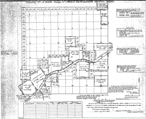
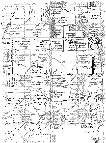
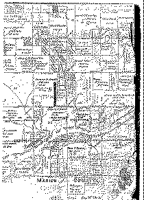
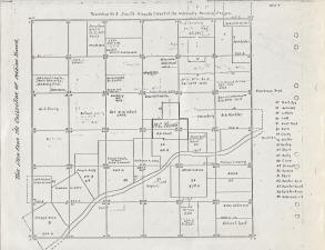
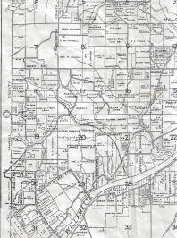
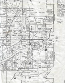
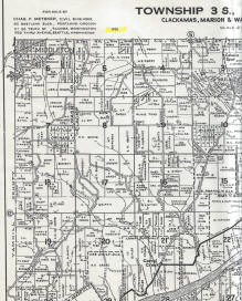
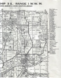
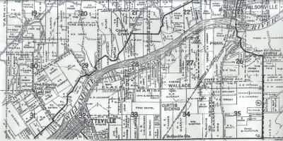
These maps are of the
area around Pleasant Hill Cemetery (later, Pleasant View
Cemetery) on Ladd Hill, south to the
Willamette River. They indicate some of the
original land claims, early family land divisions, and
land ownership. Many of the names on these maps
are recognizable from the cemetery monuments and may offer clues
to family and neighborhood relationships.
Spellings on maps were usually phonetic, so often
included spelling errors.
Click on the individual map for a much
larger and scrollable view.
|