|
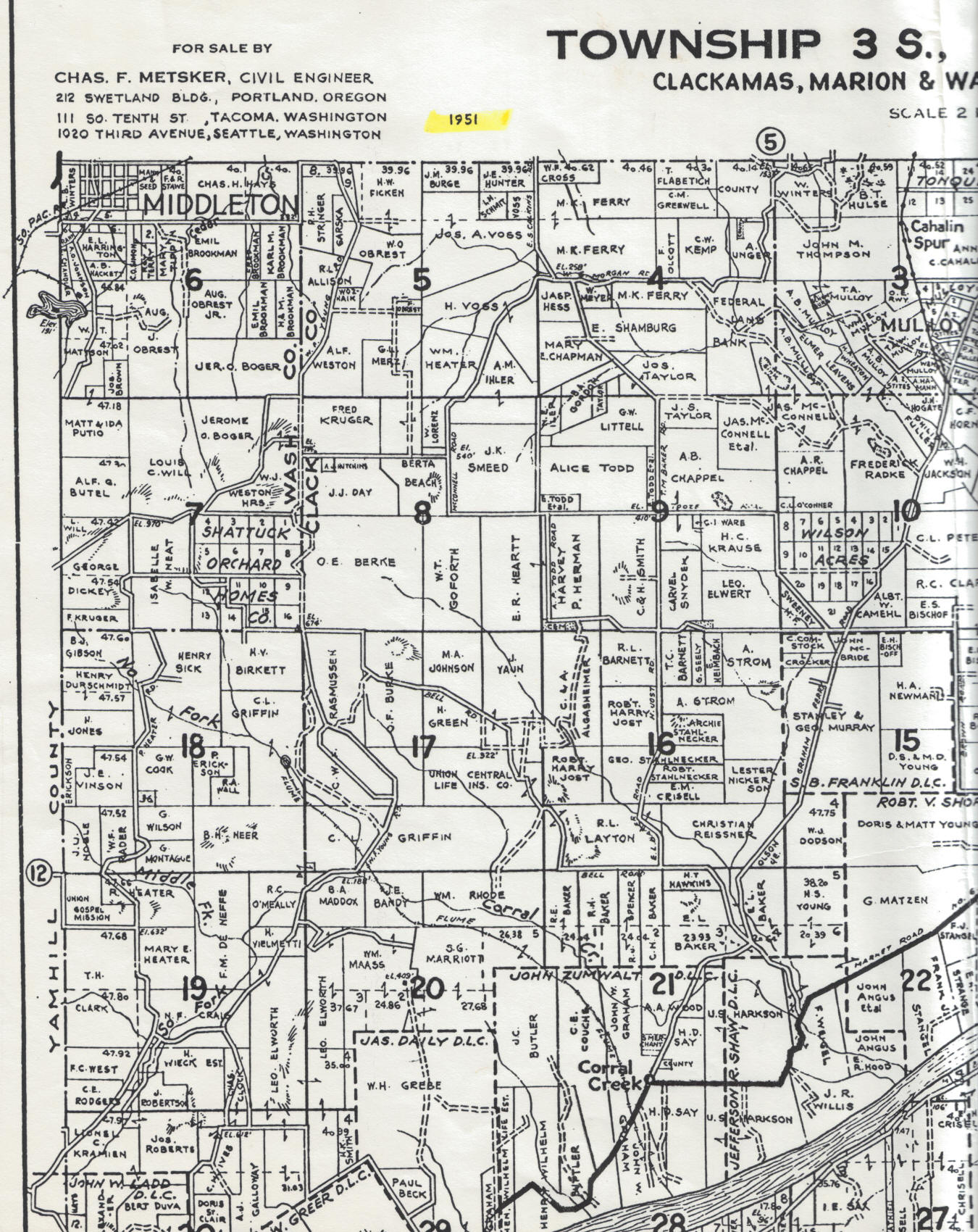
This 1951 map is of the
Ladd Hill area west of Wilsonville. The cemetery
is marked on this map as "CEM" with little
dots around it in Section 9,
south of the Harvey P. Herman property.
This map overlaps slightly with the 1951 East Section
and the 1951 South Section.
. |