|
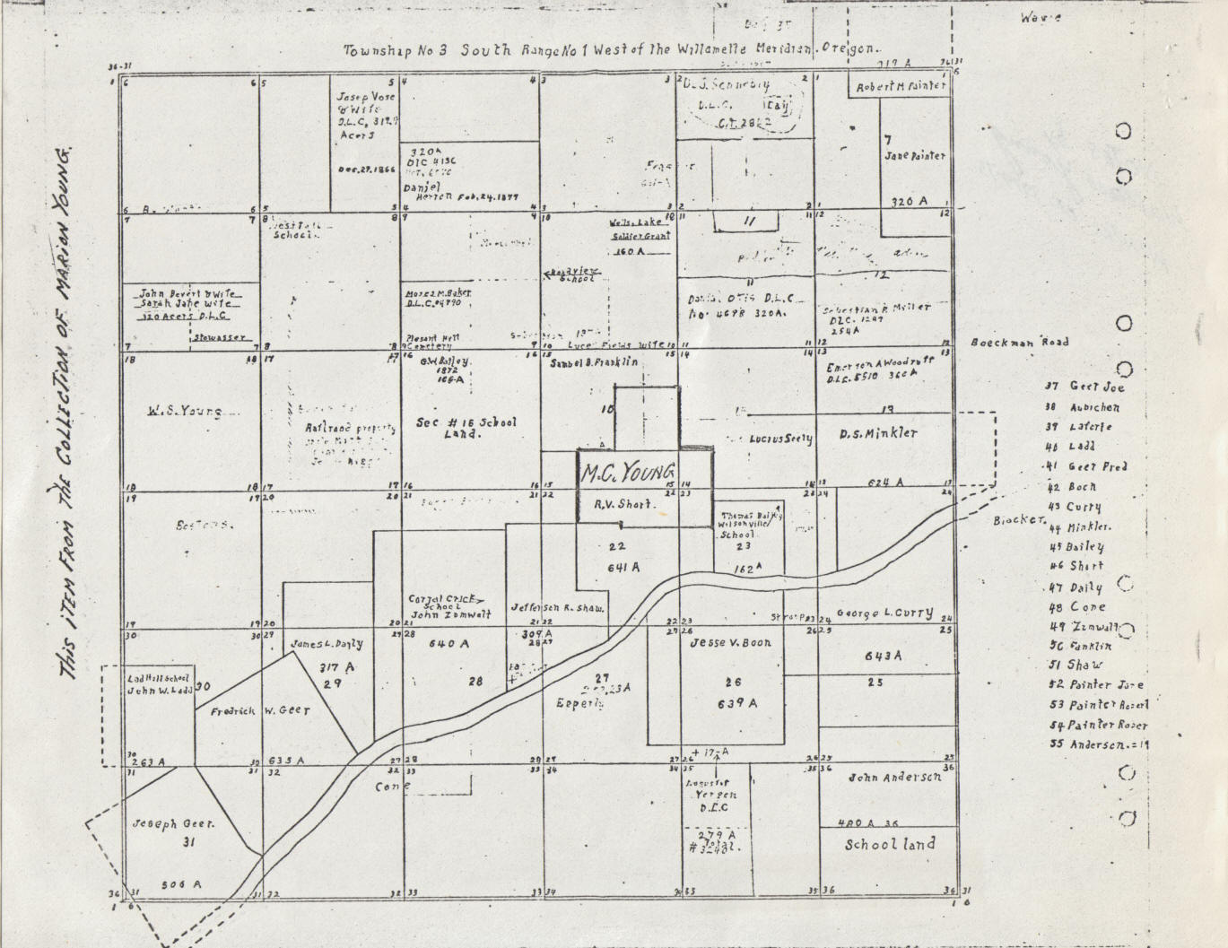
This map, drawn sometime
after 1866, is of the
area around Pleasant Hill Cemetery. The cemetery
is named here as "Pleasant Hill Cemetery" in the southern part of the Moses M. Baker
claim in the second row from the top. The path of the Willamette
River is shown. M.C. Young purchased part of the
R.V. Short and Franklin DLC's sometime in the
1880's and is penciled in to indicate that, but the
exact date
of the underlying map is unknown.
. |